
The Freedom Trail
About
The Freedom Trail is a 2.5-mile red line set into Boston's sidewalks that leads to 16 historic sites, from Boston Common to the Bunker Hill Monument in Charlestown. The citizens of Boston preserved and dedicated the route in 1951, and its stops are a mixed collection: museums, churches, meeting houses, burying grounds, parks, a ship and historic markers that tell the story of the American Revolution and what followed. The order is geographic rather than chronological, and the line runs one way without looping back, so where you finish matters as much as where you start.
It suits a first visit to Boston, a family history day or anyone who wants the city's colonial core explained on foot. Following the line costs nothing; some sites charge admission and the Freedom Trail Foundation sells guided tours. Most people begin at the Boston Common Visitor Information Center at 139 Tremont Street, which the Foundation places about 100 yards from Park Street station on the Red and Green lines. The early stretch climbs to the Massachusetts State House, and the middle of the route passes Faneuil Hall, beside Faneuil Hall Marketplace, a natural place to stop for lunch.
The route in three stretches
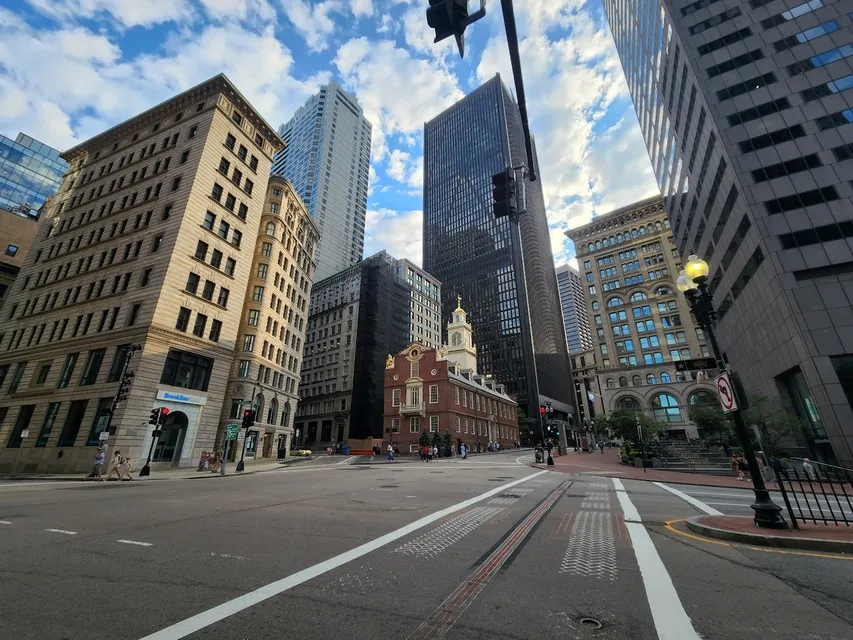
The first stretch stays around the Common: the State House, Park Street Church and the Granary Burying Ground. The second threads downtown past King's Chapel and its burying ground, the Boston Latin School site and Benjamin Franklin statue, the Old Corner Bookstore, Old South Meeting House, the Old State House, the Boston Massacre site and Faneuil Hall. The third crosses into the North End for the Paul Revere House, Old North Church and Copp's Hill Burying Ground, then continues to the USS Constitution and Bunker Hill Monument in Charlestown. Each site page on the Foundation's website gives the distance to the next stop, such as 0.2 miles and about five minutes from the Common to the State House.
Guided or on your own
The Foundation's public tours are led by guides in 18th-century costume, last 90 minutes and cover a mile or less. They stay outside the buildings, and the Foundation encourages you to go inside the sites before or after. Its most popular tour, Walk Into History, covers 11 of the 16 sites between the Common and Faneuil Hall; a separate North End tour covers Paul Revere's neighborhood. The National Park Service, whose Boston National Historical Park works with the partner sites along the trail, runs free visitor centers in Faneuil Hall and the Charlestown Navy Yard and offers ranger talks and tours in season.
What the walking is like
Expect several hills, cobblestones, brick sidewalks and some uneven ground. The Foundation says the trail is accessible but recommends a power wheelchair, publishes step-free routes between some sites, and trains its guides to adjust routes. Dogs may walk the trail but are not allowed in the burying grounds or inside the historic buildings. Tours go out in rain, snow or shine, so dress for the season.
Getting on and off by T
Park Street and Downtown Crossing serve the Common end. State and Government Center are closest to the downtown sites and Faneuil Hall, and Haymarket is the stop for the North End. For Charlestown, commuter ferries run to the Navy Yard from Long Wharf and Lovejoy Wharf.
Sources: Freedom Trail Foundation, Freedom Trail FAQ, Walk Into History tour, tours, access information, directions and parking, Boston Common site page, Boston National Historical Park. Checked September 27, 2026.
Contact Information
Boston, 02111
Photo: Anitha Kapu via Google
The Freedom Trail
About The Freedom Trail
The Freedom Trail is a 2.5-mile red line set into Boston's sidewalks that leads to 16 historic sites, from Boston Common to the Bunker Hill Monument in Charlestown. The citizens of Boston preserved and dedicated the route in 1951, and its stops are a mixed collection: museums, churches, meeting houses, burying grounds, parks, a ship and historic markers that tell the story of the American Revolution and what followed. The order is geographic rather than chronological, and the line runs one way without looping back, so where you finish matters as much as where you start.
It suits a first visit to Boston, a family history day or anyone who wants the city's colonial core explained on foot. Following the line costs nothing; some sites charge admission and the Freedom Trail Foundation sells guided tours. Most people begin at the Boston Common Visitor Information Center at 139 Tremont Street, which the Foundation places about 100 yards from Park Street station on the Red and Green lines. The early stretch climbs to the Massachusetts State House, and the middle of the route passes Faneuil Hall, beside Faneuil Hall Marketplace, a natural place to stop for lunch.
The route in three stretches
The first stretch stays around the Common: the State House, Park Street Church and the Granary Burying Ground. The second threads downtown past King's Chapel and its burying ground, the Boston Latin School site and Benjamin Franklin statue, the Old Corner Bookstore, Old South Meeting House, the Old State House, the Boston Massacre site and Faneuil Hall. The third crosses into the North End for the Paul Revere House, Old North Church and Copp's Hill Burying Ground, then continues to the USS Constitution and Bunker Hill Monument in Charlestown. Each site page on the Foundation's website gives the distance to the next stop, such as 0.2 miles and about five minutes from the Common to the State House.
Guided or on your own
The Foundation's public tours are led by guides in 18th-century costume, last 90 minutes and cover a mile or less. They stay outside the buildings, and the Foundation encourages you to go inside the sites before or after. Its most popular tour, Walk Into History, covers 11 of the 16 sites between the Common and Faneuil Hall; a separate North End tour covers Paul Revere's neighborhood. The National Park Service, whose Boston National Historical Park works with the partner sites along the trail, runs free visitor centers in Faneuil Hall and the Charlestown Navy Yard and offers ranger talks and tours in season.
What the walking is like
Expect several hills, cobblestones, brick sidewalks and some uneven ground. The Foundation says the trail is accessible but recommends a power wheelchair, publishes step-free routes between some sites, and trains its guides to adjust routes. Dogs may walk the trail but are not allowed in the burying grounds or inside the historic buildings. Tours go out in rain, snow or shine, so dress for the season.
Getting on and off by T
Park Street and Downtown Crossing serve the Common end. State and Government Center are closest to the downtown sites and Faneuil Hall, and Haymarket is the stop for the North End. For Charlestown, commuter ferries run to the Navy Yard from Long Wharf and Lovejoy Wharf.
Sources: Freedom Trail Foundation, Freedom Trail FAQ, Walk Into History tour, tours, access information, directions and parking, Boston Common site page, Boston National Historical Park. Checked September 27, 2026.